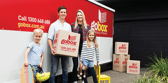
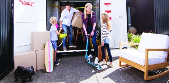
Gobox provides Melbourne’s most convenient mobile storage units, delivered directly to your home or business. Whether you’re moving, renovating, decluttering or storing business stock, we make storage simple, affordable and stress‑free.

We deliver your gobox anywhere in Melbourne.


Choose onsite storage, warehouse storage, or local/interstate moving.
Office Hours: Mon-Fri 8:30am – 5:00pm
Delivery Hours: Mon-Fri 8am - 3pm
Phone: 1300 668 688
Email: infovic@gobox.com.au
Mobile Storage Melbourne, Mobile Storage Clyde North, Mobile Storage South Morang, Mobile Storage Ringwood, Mobile Storage Point Cook, Mobile Storage Pakenham, Mobile Storage Mornington Peninsula, Mobile Storage Mitcham, Mobile Storage Lilydale, Mobile Storage Doreen, Mobile Storage Cranbourne East, Mobile Storage Cranbourne, Mobile Storage Carrum Downs, Mobile Storage Bentleigh, Mobile Storage Windsor, Mobile Storage St Kilda East, Mobile Storage St Kilda, Mobile Storage Southbank, Mobile Storage South Yarra, Mobile Storage South Melbourne, Mobile Storage Seddon, Mobile Storage Richmond, Mobile Storage Princes Hill, Mobile Storage Prahran, Mobile Storage Port Melbourne, Mobile Storage North Melbourne, Mobile Storage Moonee Ponds, Mobile Storage Maribyrnong, Mobile Storage Malvern, Mobile Storage Kingsville, Mobile Storage Kensington, Mobile Storage Hawthorn
|
Surrey Hills
|
|||||||||||||
|---|---|---|---|---|---|---|---|---|---|---|---|---|---|
|
Suburb
|
|||||||||||||
|
Surrey Gardens, which lie within Surrey Hills
|
|||||||||||||
| .mw-parser-output .locmap .od{position:absolute}.mw-parser-output .locmap .id{position:absolute;line-height:0}.mw-parser-output .locmap .l0{font-size:0;position:absolute}.mw-parser-output .locmap .pv{line-height:110%;position:absolute;text-align:center}.mw-parser-output .locmap .pl{line-height:110%;position:absolute;top:-0.75em;text-align:right}.mw-parser-output .locmap .pr{line-height:110%;position:absolute;top:-0.75em;text-align:left}.mw-parser-output .locmap .pv>div{display:inline;padding:1px}.mw-parser-output .locmap .pl>div{display:inline;padding:1px;float:right}.mw-parser-output .locmap .pr>div{display:inline;padding:1px;float:left}@media screen{html.skin-theme-clientpref-night .mw-parser-output .od,html.skin-theme-clientpref-night .mw-parser-output .od .pv>div,html.skin-theme-clientpref-night .mw-parser-output .od .pl>div,html.skin-theme-clientpref-night .mw-parser-output .od .pr>div{background:#fff!important;color:#000!important}html.skin-theme-clientpref-night .mw-parser-output .locmap img{filter:grayscale(0.6)}html.skin-theme-clientpref-night .mw-parser-output .infobox-full-data .locmap div{background:transparent!important}}@media screen and (prefers-color-scheme:dark){html.skin-theme-clientpref-os .mw-parser-output .locmap img{filter:grayscale(0.6)}html.skin-theme-clientpref-os .mw-parser-output .od,html.skin-theme-clientpref-os .mw-parser-output .od .pv>div,html.skin-theme-clientpref-os .mw-parser-output .od .pl>div,html.skin-theme-clientpref-os .mw-parser-output .od .pr>div{background:white!important;color:#000!important}html.skin-theme-clientpref-os .mw-parser-output .infobox-full-data .locmap div{background:transparent!important}}
Surrey Hills
|
|||||||||||||
|
Interactive map of Surrey Hills
|
|||||||||||||
| Coordinates: .mw-parser-output .geo-default,.mw-parser-output .geo-dms,.mw-parser-output .geo-dec{display:inline}.mw-parser-output .geo-nondefault,.mw-parser-output .geo-multi-punct,.mw-parser-output .geo-inline-hidden{display:none}.mw-parser-output .longitude,.mw-parser-output .latitude{white-space:nowrap}37°49′48″S 145°06′22″E / 37.830°S 145.106°E | |||||||||||||
| Country | Australia | ||||||||||||
| State | Victoria | ||||||||||||
| City | Melbourne | ||||||||||||
| LGAs | .mw-parser-output .plainlist ol,.mw-parser-output .plainlist ul{line-height:inherit;list-style:none;margin:0;padding:0}.mw-parser-output .plainlist ol li,.mw-parser-output .plainlist ul li{margin-bottom:0}
|
||||||||||||
| Location |
|
||||||||||||
| Government | |||||||||||||
| • State electorates |
|
||||||||||||
| • Federal divisions |
|
||||||||||||
| Area | |||||||||||||
|
• Total
|
4.4 km2 (1.7 sq mi) | ||||||||||||
| Elevation | 110 m (360 ft) | ||||||||||||
| Population | |||||||||||||
| • Total | 13,655 (SAL 2021)[2] | ||||||||||||
| Postcode |
3127
|
||||||||||||
|
|||||||||||||
Surrey Hills is a suburb of Melbourne, Victoria, Australia, 11 km east of Melbourne's Central Business District, located within the Cities of Boroondara and Whitehorse local government areas. Surrey Hills recorded a population of 13,655 at the 2021 census.
Surrey Hills was settled in the late 19th century and evolved with slightly smaller blocks and slightly simpler housing than its neighbour Canterbury. Most of Surrey Hills' streets are lined with now-mature European trees, mostly plane and pin oak.
It is bordered by Elgar Road in the east, Riversdale Road in the south, Highfield Road in the west and Whitehorse Road in the north.


I stored my personal items for 5 years with GoBox. They were affordable, professional, reliable and helpful from beginning to end.

Go box has been fantastic service was impressive from start to finish. Box was skilfully placed and removed by Tim on 2 tricky driveways with so much care . Also the advice on packing helped so much. The box was secure and clean even smelled good ! Margot was extremely helpful with booking etc. Made moving a lot less stressful . Would use again and 100 percent recommend

Go Box are excellent! Fantastic service. The box arrived and was in extremely clean condition. Collection was on time. Highly recommend. Makes moving so much easier.

So impressed with using & interacting with this business! Really friendly, action-orientated and great service. When they initially had a mix-up they couldn't have worked faster to immediately resolve it. The containers themselves are great; clean and waterproof. I'll actually miss having it on-site, as it was very practical extra space. Thank you!

People in the office and the delivery driver communicated well throughout the process and delivery 👍

We very happy with service and ability to change with our circumstances due to health problems we where going thru at the times. When you collected the the box I did a check and noticed your strap had been removed.
Warehouse Address:10-12 Commercial Street, Marleston, SA 5033
Office Hours: Mon-Fri: 9am – 5pm
Delivery Hours: Mon-Fri: 9am - 5pm
Phone: 1300 668 688
Email: infosa@gobox.com.au